Sunday 28 February 2010

What’s In A Name

Poor Park and Park Wood are the names of my two local woods. No-one seem to know why the former is called “poor” park, although it might well have derived from someone’s name. Although the local village is more than likely named by the Vikings, the French may have given names to many other local features.

PoorPark

Like it or not, there are many French connections in the countryside and most stem from the Norman invasion. Locally we have a nearby Norman castle owned by Aubrey de Vere who was one of William the Conqueror's most favoured knights. Therefore we would expect to have a substantial amount of land connected with it to be linked with the Normans. Local rumour has it that a later Normal landowner was so short of money that he was called Simon ‘the Poor’ but I’m not too sure of that one.

The word ‘park’ also has connections with the Normans, for it was they who set up deer parks for local hunting purposes.  Thus you should expect any woods with the name ‘park’ in it to have some ancient connection with deer. There were 36 deer parks named in the Domesday book and these escalated to hundreds and hundreds in England before the English civil war decimated them.

Apparently it is still possible to recognise a medieval deer park even today by the egg-shape of the land and the earthworks used as the park boundaries.

Not only were parks developed by the Normans but so were forests. These were lands legally set aside for the hunting nobility. Forest Law inflicted severe punishments for anyone found interfering with the deer in the Forest. If you were caught ‘red-handed’ i.e. blood on your hands, you could expect only one form of punishment.

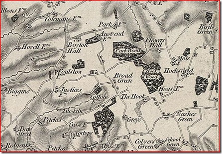
Park woods 1856

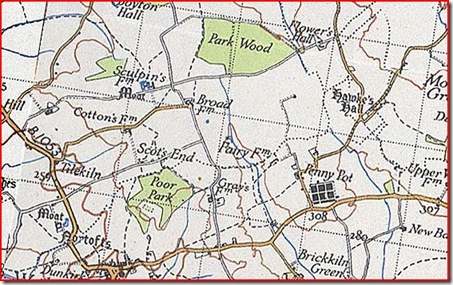
The oldest map of the two woods I can get on-line (visit www.visionofbritain.org.uk) is from 1856. I was hoping that it would show the two woods joined as one as they are not too far apart, but it doesn't quite do that. Instead there’s another wood to the south east of Park Wood called  Hook Wood. No trace of Hook Wood exists now. Poor Park are the woods to the south. There is no mention of the name Poor Park on this map.

Park Woods 1925

The next map is from 1925 and reveals that Hook Wood has disappeared. It does show the medieval Hawke’s Hall which has also now disappeared. I live just to the north of the now named Poor Park at Scot’s End, although there is now no such place as Scot’s End now.

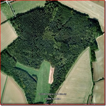
Park Wood has been significantly reduced in size and it is rarely named on maps. Interestingly, Poor Park (see the Sat Map at the top of the page) has not even changed its shape for over 150 years and is now one of the bigger woods in the area.

The council describes the woods as:

…[a] large ancient wood, originally comprising Pedunculate Oak (Quercus robur), Ash (Fraxinus excelsior), Hazel (Corylus avellana) and Field Maple (Acer campestre), has now been widely replanted with Poplars (Populus sp.) and Scots Pine (Pinus sylvestris). Despite storm damage and forestry activity, a typical woodland ground flora still survives.

I’m going to have to delve a little deeper and go back even further into the history of these woods.

Thanks for the visit.
Tuesday 23 February 2010

A Sad Phone Owner

“You never guess what happened to me?”

“Don’t tell me, you went into a Supermarket”.

“Don’t be silly. It wasn’t that bad. I got mugged”.

“What!!”

“I was standing outside the phone shop when someone rushed out and took my credit card. They ran back into the shop, came back out with my card and pushed an Apple iPhone box under my arm. Look!”

“Very funny”.

photo2

Despite cutting my computer teeth on a Commodore 64 and ever since fiddling about with a few computers, mobile technology has sort of evaded me. Until now that is. So what has turned Pablo from a mobile (cell) phone technophobe to A SAD phone owner (All Singing All Dancing - I’m going to copyright that!)

Well, it’s a number of things. Here’s a list:

  • It has email.
  • It can connect to the internet wirelessly at home or by 3G or Edge when out.
  • It has GPS.
  • It has a camera/video camera
  • You can buy and watch feature films
  • You can get and listen to audio books
  • It has an iPod
  • It has a photo album viewer
  • It has a voice recorder
  • It has some excellent and cheap applications.
  • It has text.
  • It even makes phone calls.

Some of the applications (called apps in case you didn’t know) are very good and believe it or not, some are suited for outdoor use. I believe the cry in Geeks-ville is “there’s an app for that!” So here’s my suggestions for some ‘shrafting apps:

photo3 photo4

Trip Journal

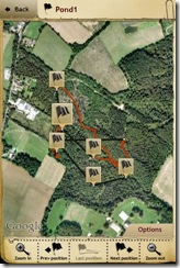
– Using the phone’s GPS, this application will track your movements over any distance. You can create waypoints, make notes or take photos if your trip. The track is overlaid onto Google maps on the phone and you can export it to Google Earth, saving your trip to your computer. The GPS accuracy is nothing like a dedicated unit but it isn’t bad. I got mine down to 24 feet in the woods. It’s surprising where you wander and how far you actually go. This app is great for trips abroad as well as local stuff.


photo5

GPS Kit

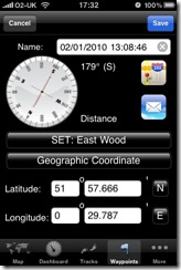
– This is more like a functional GPS unit. Put in waypoints and navigate between them or measure distance, speed, altitude etc.


photo20

Compass

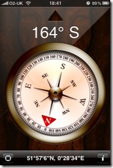
This seems like a gimmick but it actually works due to the built-in magnetometer. The normal rules apply such as using it away from magnetic fields. Most of the GPS apps have their own version, but this one is quite pretty!


photo6

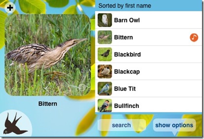
Chirp

– This application has 80 birds and their songs or alarm calls. I tested it out on a Robin who was extremely confused but then started to sing back to the phone.


photo7

Knot guide and Knots

– two very good applications that show you how to tie knots.


photo8

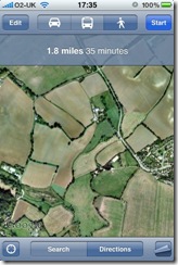
Maps

– Google maps, which together with the phone’s GPS will show you where you are and what direction you’re going both on a route map or satellite maps. The benefit of this over a normal GPS is that if there’s no GPS signal, the phone triangulates your position from cell masts. This app is pre-installed when you buy the phone.


photo9

photo19 

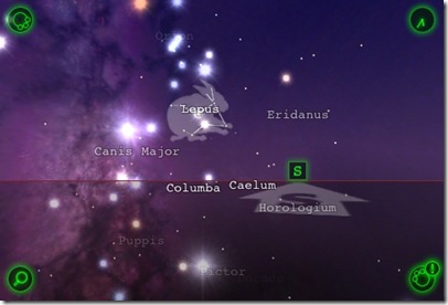
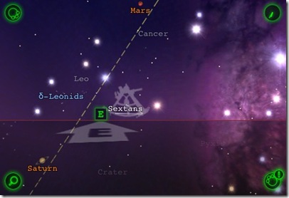
Star Walk

– A simply stunning application that shows you what stars and planets are in the sky with constellation names and drawings. You point the phone at the sky (it uses the phone’s accelerometer and GPS) and it shows you exactly what you are looking at based on your position and the direction you’re facing. A great way to learn the night sky.


photo10

TreeId

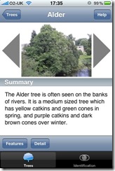
– British tree identification described by bark, shape of tree, height, flowers, leaves, nuts etc. Not a bad little reference app.


photo17

Weather Pro

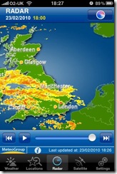
– One of many excellent weather applications. This one shows satellite and radar sequences, pressure, wind, etc.


photo11 photo12

Birds of UK and Ireland

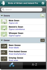
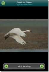
– A fully featured electronic reference book of 250 birds of the UK. Not cheap (gettit?) but saves a large reference book in your pocket (also has bird calls, distribution maps, drawings, photos).


photo14

Radio

– Not strictly an outdoor application, but some people like to get a live weather forecast from a local radio station when out on the hills.


photo15  photo

Memory map

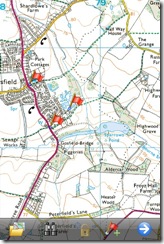
– Ordnance Survey maps for the phone. The app isn’t all that stunning for the price (£19), but you get quite a few credits for 1:25000 or 50:000 areas of your choice. What is good is that it works off-line so if you loose any signal you’ve still got the map. Of course it works with the GPS so it tracks your position and you can set waypoints like the other GPS apps. An annoying downside is when you’re following a track, the map shows only north up and not direction up. Perhaps an upgrade will fix this.


photo16

I also have a variety of other applications on the phone like a journal, daily tracker, exercise tracker, dictionary, newspaper readers, twitter, blog publishing, Paypal and Ebay and errr… a pet fish called Eric. Unfortunately, the only animal tracking application I’ve come across is one for North America.

The trouble with the phone is that it sucks its own battery dry especially if a GPS app is on for any length of time. There are ways of reducing battery consumption but you really need to charge it every night. I shelled out another £28-00 for a USB battery pack which can charge the phone 3 times from empty. This is enough for 4 – 5 days in the woods without turning the phone off.

photo18

Another problem could be the weather. An outdoor phone it ain’t therefore a sturdy case or AquaPac case is required.

This certainly isn’t a outdoor tool and it’s certainly not traditional by any means and any old cheap phone would suffice for emergency purposes; but if you’re going to be A SAD phone owner, it may as well be this one!

Sunday 21 February 2010

Hidden Gems


IMG_1503

Although I like padding around my local woods and getting to know it intimately, I also like to explore new areas. There’s quite a few nooks and crannies which are not obvious, being hidden away in some corner of the countryside.

My mate Dave (of birding fame) gave me a tip to check out an area not far from where I live. I didn't quite believe him when he said it was a Nature Reserve, but nevertheless, I set out late Saturday morning to find the place.

IMGA0488

As described, the area was hidden away a the rear of a housing estate and comprised of some small disused gravel pits and some pathways around them, complete with a grassed picnic area. I shuddered at the sight of the picnic benches and galvanised steel dustbins chained to trees and imagined the cacophony of screaming and shouting people on a fine summers day. You never know though. It may well be hidden enough away for only locals to be aware of it. For now, the place was mine alone.

IMG_1476

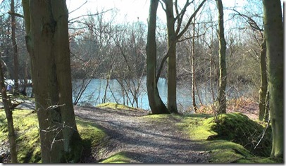
I tried to find an area off the paths to make my lunch, but soon realised that the paths were so close together that this was quite difficult. This really was a small area, but I was warming to it as I eventually found a spot overlooking one of the larger ponds.

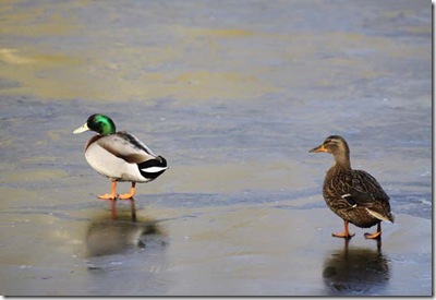
Dave had said he had seen kingfishers in the area, so I kept my camera close. Alas, I only saw the resident mallards struggling to walk on the still frozen smaller ponds, and a pair of grey wagtails.

IMGA0492

IMGA0494

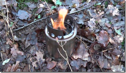
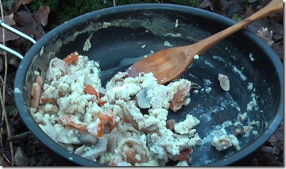
I sparked up the my bushbuddy with the Trangia burner adaption and settled down to devour some scrambled egg.

IMGA0495 

IMGA0500

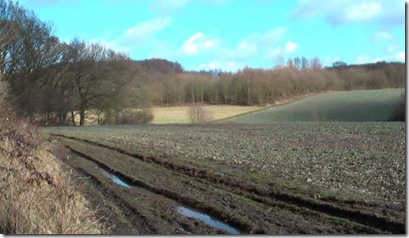
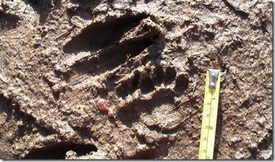
I had walked around the reserve twice when the adventurous spirit really took over, and I followed a public footpath by the side of a field which took me close to some woods. I couldn’t help but nip in and out of the woods to see what was going on and a good track trap showed roe, fallow, fox and badger.

IMGA0509

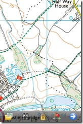
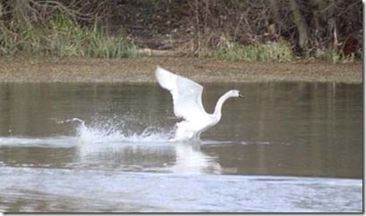
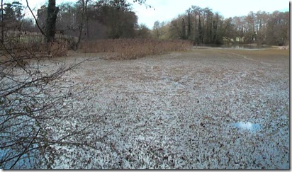
At the bottom of the valley, I came across a bit of a surprise. It was a beautiful lake complete with swans. Because of the green vegetation floating on the top (and because the photo was taken in summer) the satellite picture showed it as a paler green field. The name “Sparrows Pond” was also deceiving as it was quite a large lake (by UK standards that is.)

IMG_1484

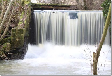
More surprises followed as at one end of the lake there was a  small dam which gushed water into a fast flowing stream and, after walking along the lake’s south side, I discovered and an old bridge across the lake. This appeared to be constructed as an ornamental bridge in better days and the whole lake complex must have formed part of the estate of the nearby medieval hall.

IMGA0510

A track from the bridge brought me almost full circle back to the nature reserve.

IMG_1501

This is certainly a hidden gem. I could imagine the place teeming with wildlife in the spring and summer and certainly worth another visit. It would also be worthwhile finding out the landowner for permission to spend some more time exploring the woods.
Thanks for the visit.